
Summary
Long before the ice wall, Europeans believed in another "beyond": a great southern continent, Terra Australis Incognita, supposed to balance the lands of the north. Aristotle and Ptolemy had sketched the idea, Gerardus Mercator and Abraham Ortelius drew it as a vast polar landmass in the 16th century, and as late as 1767 Alexander Dalrymple argued for it, estimating its population at more than 50 million.
This sheet records how the exploration of the south settled the question. Cook crossed the Antarctic Circle on 17 January 1773 and went as far as 71°10' South in 1774; sailing over most of the places where the continent was predicted, he showed that no habitable southern land existed in temperate latitudes, and he is credited with proving the Terra Australis Incognita a myth. In January 1820 Bellingshausen and Lazarev sighted the real polar mainland, far smaller and colder than the legendary one. Flinders then reserved the old name for the continent he had charted, Australia.
The episode matters for the ice-wall story. Maps of lands beyond the south were once drawn in good faith from reasoning and were corrected by voyages, whereas the current narratives rest on a fictional map and on stories that no expedition has confirmed.
Verified facts
- Verified fact
The idea of an unknown southern land is ancient: Aristotle held that the continents of the Northern Hemisphere must be balanced by an unknown landmass in the Southern Hemisphere, and Ptolemy believed the Indian Ocean was enclosed on the south by land.
- Terra Australis, Wikipedia
Aristotle hypothesised that the continents of the Northern Hemisphere must be balanced out by an unknown landmass in the Southern Hemisphere
- La découverte de l'Australie et le mythe de la Terre australe inconnue, Futura Sciences, 27 September 2018
une symétrie des masses territoriales entre les deux hémisphères Nord et Sud
- Terra Australis, Wikipedia
- Verified fact
In the 16th century, mapmakers drew this land as a huge continent around the south pole: Gerardus Mercator believed in a large Southern continent on the basis of cosmographic reasoning, and Abraham Ortelius's 1570 world map labels it Terra Australis Nondum Cognita, "the southern land not yet known".
- Terra Australis, Wikipedia
Gerardus Mercator believed in the existence of a large Southern continent on the basis of cosmographic reasoning
- Terra Australis, Wikipedia
- Verified fact
As late as 1767 the geographer Alexander Dalrymple argued for the Southern Continent, writing that its number of inhabitants was probably more than 50 millions.
- Terra Australis, Wikipedia
The number of inhabitants in the Southern Continent is probably more than 50 millions
- Terra Australis, Wikipedia
- Verified fact
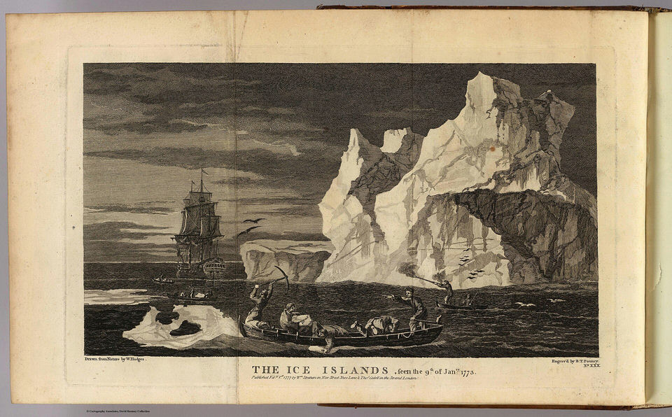
On 17 January 1773, James Cook's Resolution became the first ship to cross the Antarctic Circle; the third and last crossing, on 3 February 1774, was the most southerly, at 71°10' South.
- Second voyage of James Cook, Wikipedia
On 17 January 1773, Resolution was the first ship to venture south of the Antarctic Circle
- Second voyage of James Cook, Wikipedia
- Verified fact
Cook's sweeps across the Pacific showed there was no Terra Australis in temperate latitudes; Cook proved the Terra Australis Incognita to be a myth, a conclusion Futura Sciences summarises as the clear non-existence of the mythical southern land.
- Second voyage of James Cook, Wikipedia
Cook proved the Terra Australis Incognita to be a myth
- La découverte de l'Australie et le mythe de la Terre australe inconnue, Futura Sciences, 27 September 2018
Et son rapport conclut clairement sur la non-existence de la mythique
- Second voyage of James Cook, Wikipedia
- Verified fact
In January 1820 the Russian expedition of Bellingshausen and Lazarev crossed the Antarctic Circle on the 26th and, on 27 January (New Style), discovered the Antarctic mainland.
- Fabian Gottlieb von Bellingshausen, Wikipedia
On 27 January, the expedition discovered the Antarctic mainland
- Fabian Gottlieb von Bellingshausen, Wikipedia
- Verified fact
Matthew Flinders concluded that the Terra Australis imagined by Aristotle and Ptolemy did not exist and proposed the name "Australia" for the land he had charted, which made the old name stick to the real continent.
- Terra Australis, Wikipedia
Flinders had concluded that the Terra Australis as hypothesised by Aristotle and Ptolemy did not exist
- Terra Australis, Wikipedia