
Summary
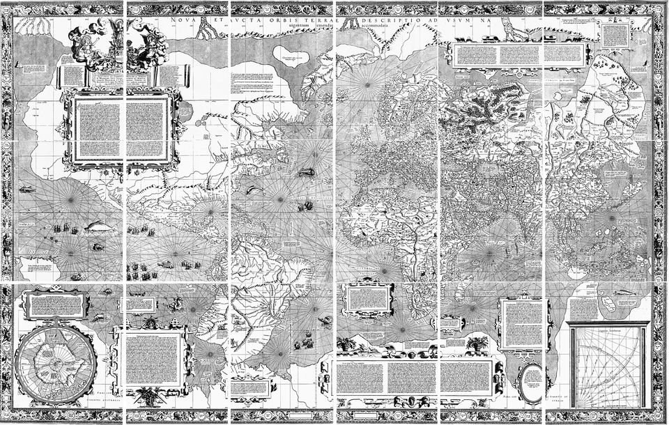
Historians of cartography read the Piri Reis map and Finé's world map as products of their time. For Piri Reis, scholars attribute the unusual arrangement of the Caribbean to a now-lost map by Columbus, which explains why Cuba and Central America seem fused. The southern coast of the Atlantic Ocean on the map is most likely a version of Terra Australis, the Southern Land. That idea is very old: Aristotle held that the northern continents had to be balanced by an unknown landmass in the south, and Ptolemy believed the Indian Ocean was enclosed on the south by land. Mapmakers of the Renaissance therefore drew a southern continent as an expected feature, not as a surveyed one. Finé's map follows this tradition: his cosmography was derived from the German cosmographer Johannes Schöner, and the legend on his southern land refers to the discovery of Tierra del Fuego by Magellan. As explorers charted the southern hemisphere, the imagined continent shrank, and the belief in it was abandoned after James Cook's second voyage in the 1770s. Specialists also correct the claim of exceptional accuracy: a comparison with other maps of the period found that the Piri Reis map is not the most accurate of its century. Hapgood's own interpretations met with skepticism and were later discredited by research on Antarctic ice.
Official version
- Official version
Scholars attribute the peculiar arrangement of the Caribbean on the Piri Reis map to a now-lost map from Columbus.
- Piri Reis map, Wikipedia
Scholars attribute the peculiar arrangement of the Caribbean to a now-lost map
- Piri Reis map, Wikipedia
- Official version
The southern coast of the Atlantic Ocean on the Piri Reis map is most likely a version of Terra Australis.
- Piri Reis map, Wikipedia
The southern coast of the Atlantic Ocean is most likely a version of Terra Australis
- Piri Reis map, Wikipedia
- Official version
The idea of a southern land is ancient: Aristotle held that the northern continents must be balanced by an unknown southern landmass, and Ptolemy believed the Indian Ocean was enclosed on the south by land.
- Terra Australis, Wikipedia
Aristotle hypothesised that the continents of the Northern Hemisphere must be balanced out by an unknown landmass in the Southern Hemisphere
- Terra Australis, Wikipedia
- Official version
Finé's cosmography was derived from the German cosmographer Johannes Schöner, and the legend on his southern land refers to the discovery of Tierra del Fuego by Ferdinand Magellan.
- Oronce Finé, Wikipedia
Fine's cosmography was derived from the German mathematician and cosmographer Johannes Schöner
- Oronce Finé, Wikipedia
- Official version
Belief in the Southern Continent was abandoned after the second voyage of James Cook in the 1770s showed that, if it existed, it was much smaller than imagined.
- Piri Reis map, Wikipedia
Belief in the Southern Continent was abandoned after the second voyage of James Cook in the 1770s
- Piri Reis map, Wikipedia
- Official version
A comparison with other portolan-style maps found that the Piri Reis map is not the most accurate map of the sixteenth century, as has been claimed.
- Piri Reis map, Wikipedia
The Piri Reis map is not the most accurate map of the sixteenth century, as has been claimed
- Piri Reis map, Wikipedia
- Official version
Later research on Antarctic paleoclimatology and ice sheets has discredited Hapgood's interpretations that any part of Antarctica had been ice-free in the recent past.
- Charles Hapgood, Wikipedia
have discredited the interpretations by Hapgood
- Charles Hapgood, Wikipedia